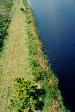
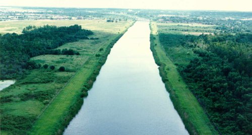
 1983 aerial photo of canal bank. Note 10 to 20 feet of thick vegetation.
Specifications (unverified draft)
Purpose: Flood Control
Constructed by: Army Corps of Engineers
Maintenance and control structure operation by: SWFWMD
Maximum flow rate: x gallons per hour
Control Mechanism: Automatic or Manual. Automatic mode (water
level/current triggers gate opening and closing) is no longer used after
a malfunction in 1990 drained too much water.
History (unverified draft)
1967 - Army Corps of Engineers begin construction
1968 - Construction Complete
1968 to 1984: Canal banks are not accessible via public road.
Waterway accessible via boat from Lake Tarpon. No restrictions on
boating usage.
1970: SWFWMD does study of canal bank erosion to decide whether
to dredge banks periodically or let vegetation grow. Study documents
zero erosion in areas where vegetation is left in place, even with unrestricted
boat wakes.
1984: Enforcement of "no wake" ordinance begins. World-class
ski area is shut down.
1993: Sewer pipe is installed over North end of canal for new development.
A temporary permit is issued, specifying that it will be removed when a
new main along East Lake Road is installed.
1994: Construction of houses and condos on East side begins.
February 1998: About 2 feet of water is inadvertently drained from
the lake.
Pictures click on each picture for a larger one
1983 aerial photo of canal bank. Note 10 to 20 feet of thick vegetation.
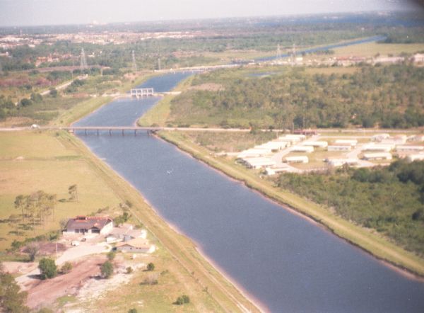
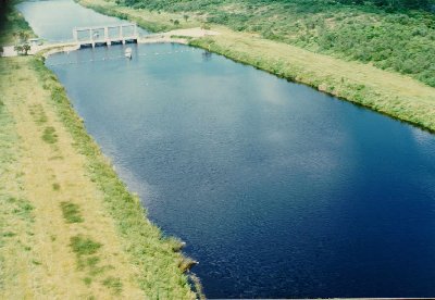 1983 aerial of flood control structure, facing North over salt water (South)
side.
1983 aerial of flood control structure, facing North over salt water (South)
side.
 1983 aerial of North end, facing East. The top is Boot Ranch, the
bottom is county preservation area, and to the left is the mouth. Note
the thick vegetation on both sides. A sewer pipe was installed in
the early 90's to the right of the bend.
1983 aerial of North end, facing East. The top is Boot Ranch, the
bottom is county preservation area, and to the left is the mouth. Note
the thick vegetation on both sides. A sewer pipe was installed in
the early 90's to the right of the bend.
 1998 aerial, North end of canal facing southeast, towards Boot Ranch.
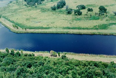
 1983 aerial of North end, facing South. Left is Boot Ranch, right
is preservation. Much of the vegetation on the East (left) side has been
removed.
1983 aerial of North end, facing South. Left is Boot Ranch, right
is preservation. Much of the vegetation on the East (left) side has been
removed.
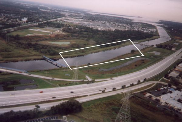 1998 aerial of once-proposed ski area between Tampa Road and dam.
Canal Park is just above ski area, Tampa Bay is to the right.
1998 aerial of once-proposed ski area between Tampa Road and dam.
Canal Park is just above ski area, Tampa Bay is to the right.
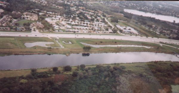 1998 aerial, reverse view of above, facing West. Lake George is in
the upper right, McMullen-Booth/East Lake road is parallel to canal.
Note the retention area to capture runoff from the subdivision on the far
side of the road.
1998 aerial, reverse view of above, facing West. Lake George is in
the upper right, McMullen-Booth/East Lake road is parallel to canal.
Note the retention area to capture runoff from the subdivision on the far
side of the road.
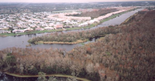
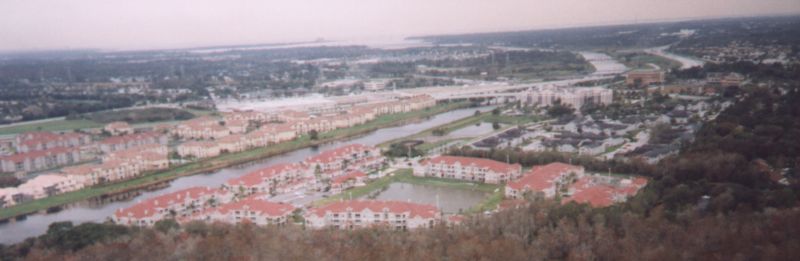 1998 aerial facing southeast. Foreground is new condos, far side
of canal is Boot Ranch.
1998 aerial facing southeast. Foreground is new condos, far side
of canal is Boot Ranch.
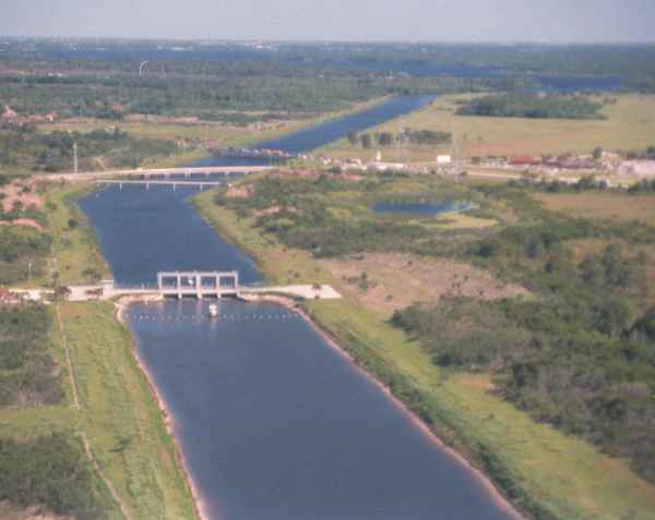 1983 aerial just south of the dam, facing North. The future Canal
Park is on the right.
1983 aerial just south of the dam, facing North. The future Canal
Park is on the right.
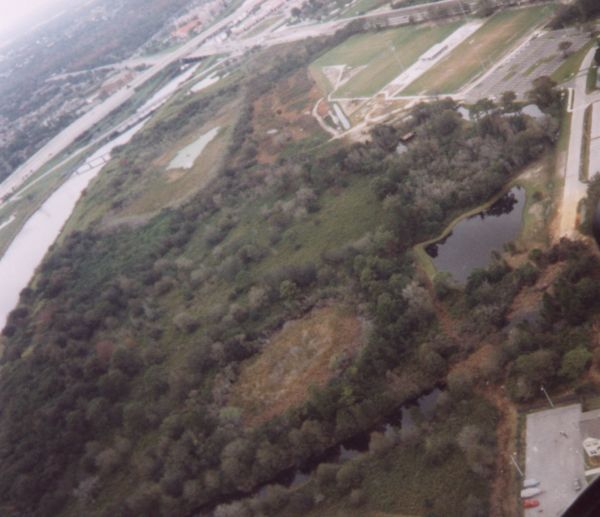 1998 aerial of canal park, facing Northwest. East Lake and Tampa
Road intersect in the upper left.
1998 aerial of canal park, facing Northwest. East Lake and Tampa
Road intersect in the upper left.
 1983 aerial further south, same angle.
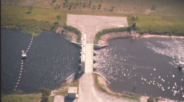 1983 close up of the dam, facing slightly East. The top area is where
a small boat can be dragged from freshwater to salt water and vise versa.
1983 close up of the dam, facing slightly East. The top area is where
a small boat can be dragged from freshwater to salt water and vise versa.
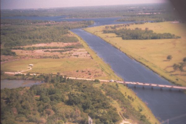 1983 aerial of Tampa Road facing North. Boot ranch is on the right.
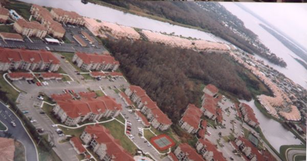 1998 aerial of Boot Ranch, facing Northwest. Upper right is the South
Cove leading to the open lake.
1998 aerial of Boot Ranch, facing Northwest. Upper right is the South
Cove leading to the open lake.
If you have any interesting facts to add, please email me at  .
.
Back to the Lake Tarpon Information Center
2/21/98